


Day 63-69: mile 1044.3-1196.5
Kennedy Meadows North-Sierra City
-
-
- Sunset near the Blue Lakes. Even though the skies seemed calm and my Garmin weather report said clear skies, at midnight I was awoken by a sudden downpour and windstorm. I had to hastily set up my rain tarp and somehow managed to avoid total soaking.
- Sunrise near Carson Pass.
- The wildflowers were in full bloom during the month of July.
- Trees with moss lines indicating the average hight of the winter snowfall.
- Gear reset during a zero in Reno. I finally got an actual tent with a bug net after spending most of the Sierras and Desert sections of the trail cowboy camping with a tarp for back up.
- View looking down the Palisades ski hill near the Tahoe Rim Trail.
-


Day 70-76: mile 1196.5-1370.8
Sierra City-Lassen National Park/Old Station
-
-
- Sunrise over the burn zone near Belden, CA. North California is notorious for its hot and exposed burn zones caused by massive fires like the Dixie fire in 2021. It’s best to start hiking early to take advantage of the cooler hours when passing through these scars.
- The geological halfway point where hikers exit the Sierras enter the Cascades is shortly before…
- … the millage halfway point! I reached 1325 miles just outside of Chester California on my 75th day on trail. The feeling was bittersweet: excitement for having come so far followed by sadness knowing the second half would go by much faster.
- Hikers have started drawing on the diamond blazes that mark the trail, maybe to relive some of their NorCal blues after leaving the Sierras. Some are silly jokes and phrases, others are more artistic like this one. No one seems to mind the graffiti on the PCT, which is a notable difference from my experience on the Colorado Trail in 2020. Any graffiti on the CT was quickly condemned by other hikers, with comments on FarOut reiterating the Leave No Trace ethos hikers follow.
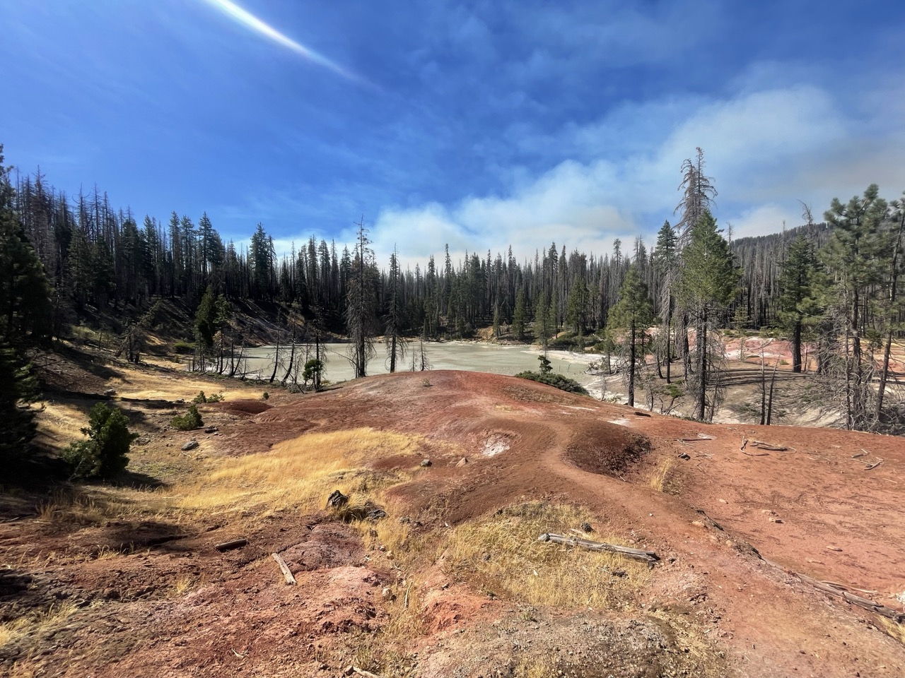
- View of Boiling Lake in Lassen National Park. What started as a blue sky day quickly turned into…
- …running north from the smoke of the Park fire that had recently started just south of where I was on trail. View of the building smoke from Drakesbad in Lassen National Park.
- Lunch was spent in the smoke on the shores of Lower Twin Lake.
- By the afternoon, visibility had dropped considerably creating an ominous atmosphere in the already burned sections of Lassen that the trail passes through. While I wasn’t able to see any of the peaks through the smoke, the birds were out in full force, filling the burnt and smokey trees with their song. The park ended up closing due to the fire the day after I cleared Old Station, just north of the park border. I was lucky to avoid the chaos of getting stranded in Chester like many other hikers did. The air quality was extremely poor for the next couple of days on trail, but began to clear as the trail turned west and began its circumnavigation of Mt. Shasta.
-